
Aripuanã Airport
 Aripuanã · ブラジル· Aripuanã Airport
Aripuanã Airport(IATA: AIR、ICAO: SSOU)はAripuanã、ブラジルにある小型空港です。
Aripuanã Airport is a small airport, at an elevation of about 755 ft. This page gathers its location map, airport codes and travel information.
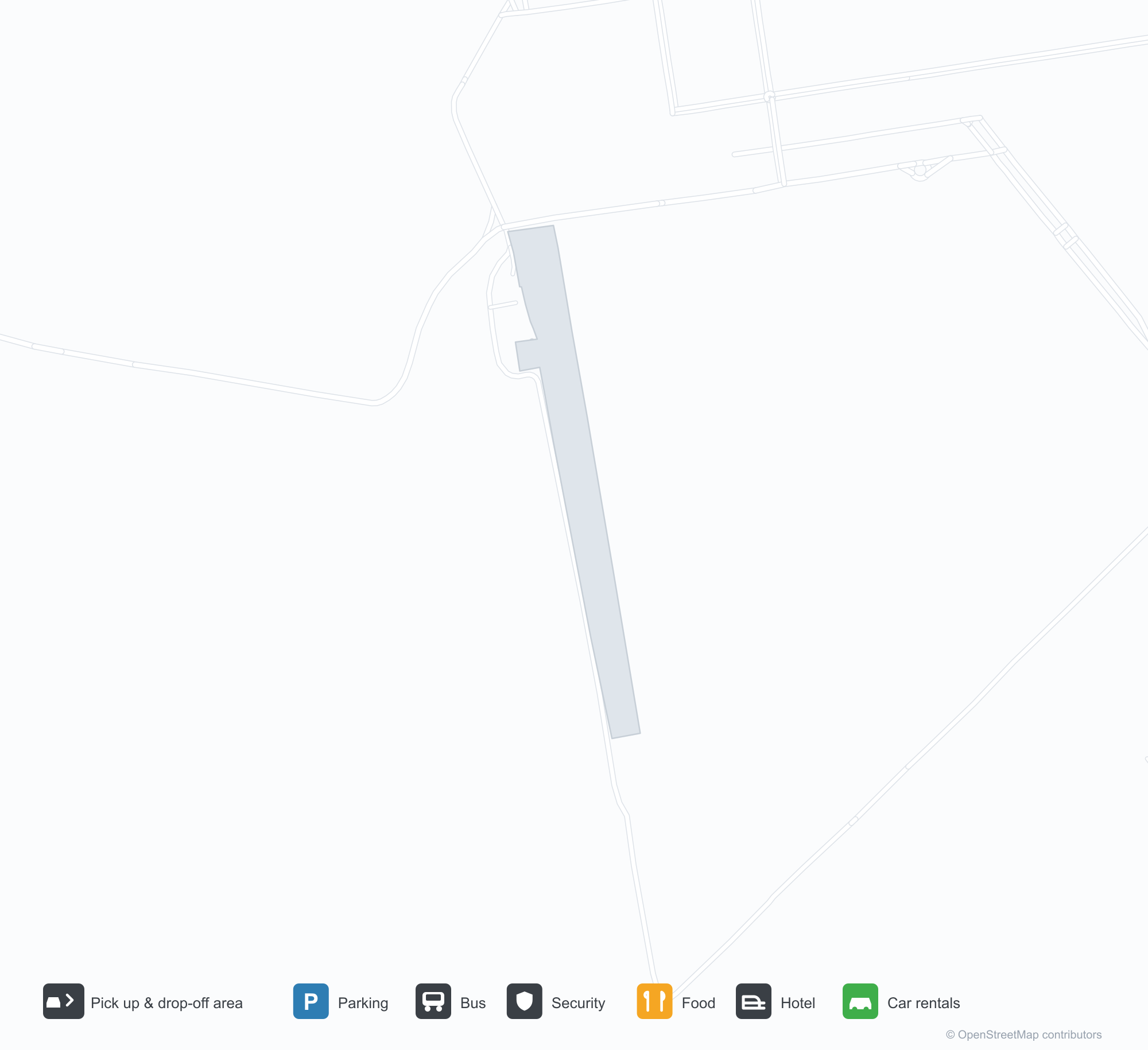
空港マップをダウンロードダウンロード
空港写真空港写真
この空港の実際の写真です。いずれも公開ウェブページを出典として明記しており、著作権は撮影者に帰属します。写真をクリックすると拡大表示され、クレジットをクリックすると元のページが開きます。
衛星画像:アリプアナン空港(AIR)は町、農地、植生の間に位置する。
Aripuanã Airport発着便 — 出発と到着フライトボード
便名2件、1社の航空会社、1か所の目的地を出発・到着別に掲載しています。コードシェア便も含みます。
| 便 | 航空会社 | 目的地 | 国・地域 |
|---|---|---|---|
| AD5124 | Azul Brazilian Airlines | Cuiabá (CGB) Várzea Grande–Marechal Rondon International Airport | ブラジル |
便名と路線はaviability.comのフライトインデックス(スナップショット:2026年10月26日)に基づきます。コードシェア便を含み、出発時刻は掲載していません。出典:aviability.com ↗
空港情報と詳細空港の詳細
インタラクティブマップ — Aripuanã Airportの位置インタラクティブマップ
他の地図サービスでこの空港を見る:
Aripuanã Airport (AIR) Guide: Where the route map stops空港ガイド
Aripuanã Airport (AIR) serves Brazil. Seen from above, it sits among dry ground broken by vegetation and fields; its elevation is about 230 m above sea level and it has a single 1,400 m runway. No scheduled non-stop services are recorded for 2014. The nearest airport is Brigadeiro Camarão Airport (287 km).
Satellite view
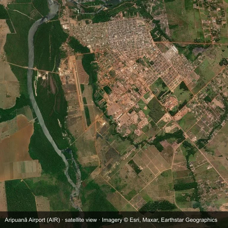
Satellite view: Aripuanã Airport (AIR) set among dry ground broken by vegetation and fields.
Satellite imagery © Esri, Maxar, Earthstar Geographics; the field and attribution are labelled in the image. This is an overhead view, not a ground-level photograph.
Airport at a glance
| Item | Detail |
|---|---|
| IATA / ICAO | AIR / SSOU |
| Role | small airport |
| Elevation | about 230 m |
| Coordinates | -10.1874, -59.4575 |
| Runways | 1, longest 1,400 m |
| Non-stop destinations | 0 in the 2014 snapshot |
Runways
| Runway | Length | Surface |
|---|---|---|
| 18/36 | 1,400 m | GRE |
Why there is no route table
The 2014 snapshot lists no destinations from AIR. Schedules for fields this size change quietly, so verify with the operator rather than assuming there is no service.
Nearby airports
| Airport | Distance | Non-stop destinations |
|---|---|---|
| Brigadeiro Camarão Airport (BVH) | ~287 km | 1 |
| Piloto Osvaldo Marques Dias Airport (AFL) | ~369 km | 1 |
| Governador Jorge Teixeira de Oliveira International Airport (PVH) | ~515 km | 4 |
Getting there and navigating
- Coordinates: -10.1874, -59.4575
- Open in a map: Google Maps | Amap | Baidu Maps
The map on this page shows the airfield and nearby roads. Terminal connections and local transport are not covered here; the operator can confirm them.
Local context
The site at Aripuanã Airport is set in dry ground broken by vegetation and fields in Brazil. Its main runway, 18/36, is aligned north–south and measures 1,400 m; the field lies at about 230 m.
With 1,400 m of runway, the airport sits in the turboprop and light-jet bracket. The surface type is not listed in the open data. The closest airport, Brigadeiro Camarão Airport, lies 287 km away, with 1 destination in the same snapshot.
Because no scheduled routes were captured in 2014, the practical question is charter or private access; ask the operator before building an itinerary around it.
Before you fly
- At 1,400 m, the runway suits turboprops and smaller jets rather than widebodies; confirm the aircraft type with the operator.
- The runway is paved, which supports year-round operations, but scheduled service is still not guaranteed.
- Brigadeiro Camarão Airport is 287 km away with 1 destination in the 2014 snapshot, making it the nearest alternative for a scheduled flight.
- Treat this as a general-aviation or charter field rather than a large terminal; confirm handling and opening hours in advance.
- The site has no terminal guide on this page, so allow extra time for local arrangements and onward transport.
About the data
Runway and location data follow OurAirports. The route table is the June 2014 OpenFlights snapshot and may lag current airline schedules.
読者コメントディスカッション
質問、旅行記、訂正など、お気軽にお寄せください。コメントは公開されます。
読み込み中…
コメントを読み込み中…