
Almería Airport
 Almería · Spanyol· Almería Airport
Almería Airport (IATA: LEI, ICAO LEAM) adalah bandara sedang yang melayani Almería, Spanyol.
Almería Airport is a medium-sized airport, at an elevation of about 70 ft, with scheduled passenger service. This page gathers its location map, airport codes and travel information.
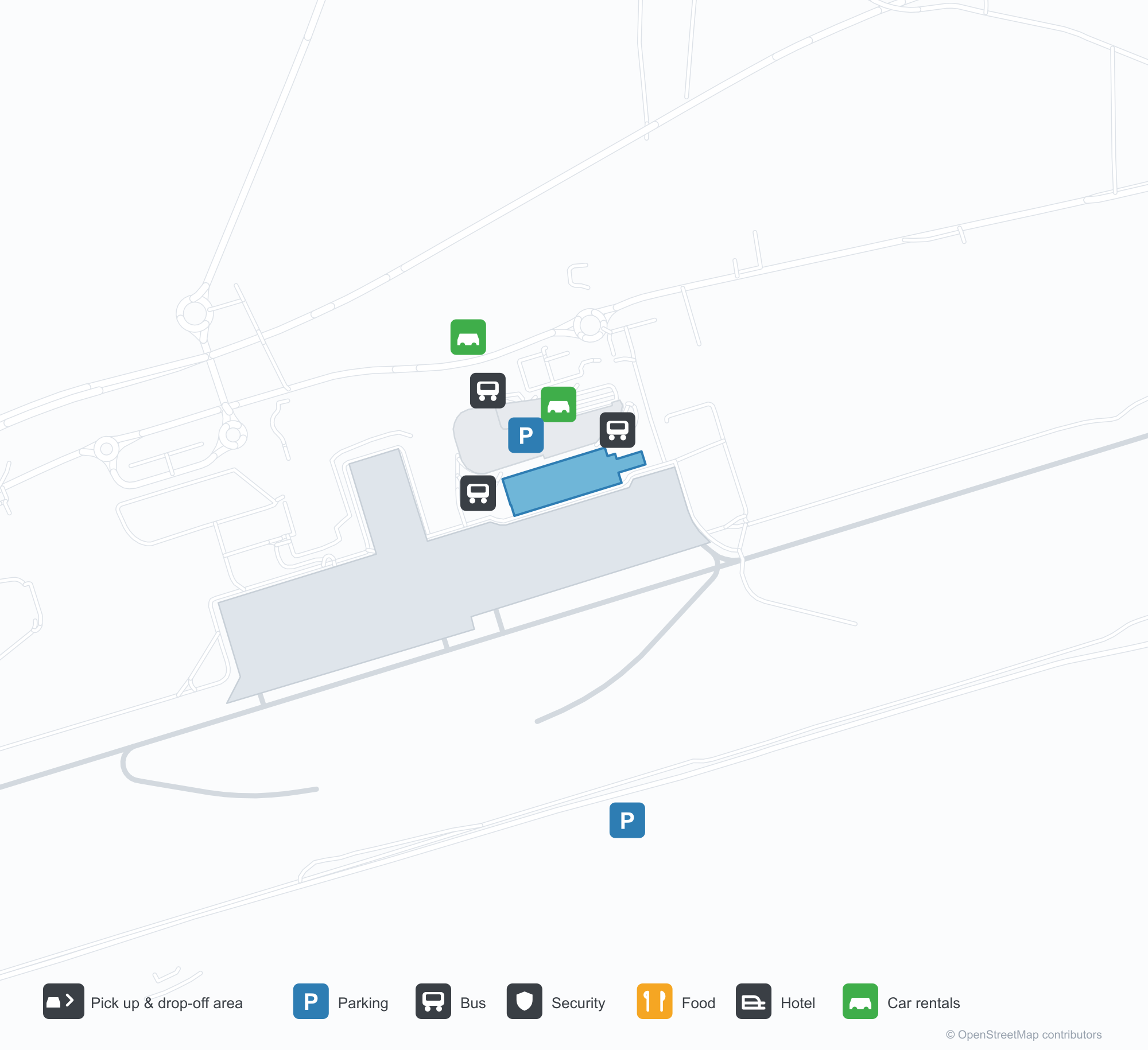
Unduh Peta BandaraUnduhan
Foto bandaraFoto Bandara
Foto asli bandara ini, masing-masing dikreditkan ke halaman web publik tempat foto ditemukan; hak cipta tetap milik fotografer aslinya. Klik foto untuk memperbesar, atau baris kredit untuk membuka halaman sumbernya.
Citra satelit: landasan pacu mengikuti pesisir Almería, dengan terminal dan apron di ujung baratnya dan Mediterania di bawahnya.
Peta rute Almería Airport — tujuan langsungPeta Rute
15 tujuan langsung: peta, maskapai yang beroperasi, dan jarak.
Penerbangan Almería Airport — keberangkatan & kedatanganPapan Penerbangan
135 nomor penerbangan dari 19 maskapai dan 18 tujuan, dipisahkan menurut arah. Nomor codeshare disertakan.
| Penerbangan | Maskapai | Tujuan | Negara/wilayah |
|---|---|---|---|
| AA8856 | American Airlines | Bandara Madrid–Barajas | Spanyol |
| AT5369 | Royal Air Maroc | Bandara Madrid–Barajas | Spanyol |
| AT5370 | Royal Air Maroc | Bandara Madrid–Barajas | Spanyol |
| AY4834 | Finnair | Bandara Madrid–Barajas | Spanyol |
| AY5618 | Finnair | Bandara Madrid–Barajas | Spanyol |
| BA4283 | British Airways | Bandara Madrid–Barajas | Spanyol |
| BA4284 | British Airways | Bandara Madrid–Barajas | Spanyol |
| BA4286 | British Airways | Bandara Madrid–Barajas | Spanyol |
| BA4288 | British Airways | Bandara Madrid–Barajas | Spanyol |
| BT5068 | airBaltic | Bandara Madrid–Barajas | Spanyol |
| FR220 | Ryanair | Manchester Airport | Inggris |
| FR1259 | Ryanair | Charleroi (CRL) Brussels South Charleroi Airport | Belgia |
| FR8352 | Ryanair | Bandara London Stansted | Inggris |
| FR9059 | Ryanair | Manchester Airport | Inggris |
| IB1030 | Iberia | Bandara Madrid–Barajas | Spanyol |
| IB1032 | Iberia | Bandara Madrid–Barajas | Spanyol |
| IB1034 | Iberia | Bandara Madrid–Barajas | Spanyol |
| IB1036 | Iberia | Bandara Madrid–Barajas | Spanyol |
| IB1038 | Iberia | Bandara Madrid–Barajas | Spanyol |
| IB2014 | Iberia | Melilla (MLN) Melilla Airport | Spanyol |
Nomor penerbangan dan rute dari indeks penerbangan aviability.com (cuplikan 26 Oktober 2026); nomor codeshare disertakan dan waktu keberangkatan tidak ditampilkan. Sumber: aviability.com ↗
Informasi & detail bandaraDetail Bandara
Peta interaktif — lokasi Almería AirportPeta Interaktif
Lihat bandara ini di layanan peta lain:
Almería Airport (LEI): A Coastal Runway and Ten International RoutesPanduan Bandara
Seen from above, the runway follows the Almería coast, with the terminal and apron at its western end, the Mediterranean below and white greenhouses and arid hills around. The airport serves Almería in Andalusia, Spain, at an elevation of about 21 m, with a 3,200 m runway; the 2014 snapshot records 15 destinations, 5 domestic and 10 international, from Melilla at 182 km to Dublin at 1,869 km.
Satellite view
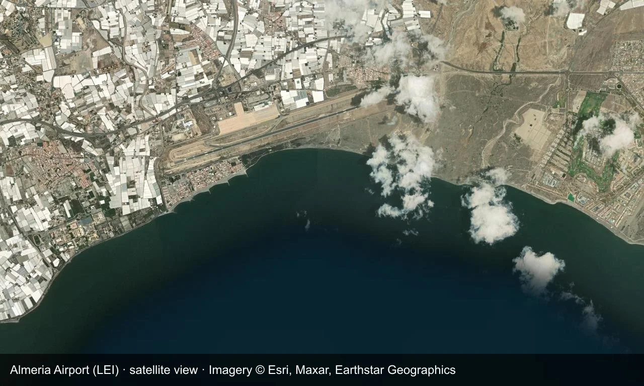
Satellite view: the runway follows the Almería coast, with the terminal and apron at its western end and the Mediterranean below.
The satellite image comes from Esri World Imagery (© Esri, Maxar, Earthstar Geographics); the field and attribution are labelled in the image. This is a satellite view, not a ground-level photograph.
Airport at a glance
| Item | Detail |
|---|---|
| IATA / ICAO | LEI / LEAM |
| Role | Medium-sized airport |
| Elevation | about 21 m |
| Coordinates | 36.8439, -2.3701 |
| Runways | 1, 3,200 m |
| Non-stop destinations | 15 (5 domestic, 10 international; 2014 snapshot) |
| Official site | www.aena.es/en/almeria.html |
Runways
| Runway | Length | Width | Surface |
|---|---|---|---|
| 07/25 | 3,200 m | 45 m | asphalt |
1 runway, the longest 3,200 m.
Non-stop routes
15 non-stop destinations, nearest first (OpenFlights route snapshot compiled in 2014 — confirm with the airline or airport):
| Destination | Distance | Carriers |
|---|---|---|
| Melilla Airport (MLN) | ~182 km | Iberia Airlines |
| Seville Airport (SVQ) | ~319 km | Air Europa |
| Adolfo Suárez Madrid–Barajas Airport (MAD) | ~419 km | Iberia Airlines, Air Europa |
| Palma de Mallorca Airport (PMI) | ~538 km | Air Berlin |
| Josep Tarradellas Barcelona-El Prat Airport (BCN) | ~626 km | Iberia Airlines, Vueling Airlines |
| London Gatwick Airport (LGW) | ~1600 km | easyJet |
| Brussels South Charleroi Airport (CRL) | ~1609 km | Ryanair |
| Brussels Airport (BRU) | ~1655 km | HQ |
| London Stansted Airport (STN) | ~1685 km | Ryanair |
| Birmingham Airport (BHX) | ~1736 km | Monarch Airlines |
| Weeze (Niederrhein) Airport (NRN) | ~1773 km | Ryanair |
| East Midlands Airport (EMA) | ~1780 km | Ryanair |
| Amsterdam Airport Schiphol (AMS) | ~1808 km | Transavia Holland |
| Manchester Airport (MAN) | ~1835 km | Transavia France, Monarch Airlines |
| Dublin Airport (DUB) | ~1869 km | Ryanair |
The carrier column comes from the same snapshot and includes codeshare and interline services; treat it as an indication of how busy the route is and check the airline for who actually flies it.
Nearby airports to compare
If the fares are close, these are the nearest airports of the same class (medium-sized airport) — straight-line distance, with their own non-stop counts from the same dataset:
| Airport | Distance | Non-stop destinations |
|---|---|---|
| Albacete Airport / Los Llanos Air Base (ABC) | ~238 km | — |
| Ain Arnat Airport (QSF) | ~692 km | 4 |
Before you fly
- Allow 2 hours for an international departure; Ryanair's fare excludes checked bags, so include those fees when comparing.
- The 15 destinations are a 2014 snapshot and seasonal routes on the Spanish coast change; check current schedules.
About the data
Runways, elevation and coordinates come from OurAirports open data. Routes and carriers come from the June 2014 OpenFlights snapshot and include codeshares and interline services; they indicate network shape and scale, not current schedules.
Komentar pembacaDiskusi
Pertanyaan, laporan perjalanan, dan koreksi sangat kami harapkan. Komentar bersifat publik.
Memuat…
Memuat komentar…