
Apataki Airport
 Apataki · Polinesia Prancis· Apataki Airport
Apataki Airport (IATA: APK, ICAO NTGD) adalah bandara kecil yang melayani Apataki, Polinesia Prancis.
Apataki Airport is a small airport, at an elevation of about 8 ft, with scheduled passenger service. This page gathers its location map, airport codes and travel information.

Unduh Peta BandaraUnduhan
Foto bandaraFoto Bandara
Foto asli bandara ini, masing-masing dikreditkan ke halaman web publik tempat foto ditemukan; hak cipta tetap milik fotografer aslinya. Klik foto untuk memperbesar, atau baris kredit untuk membuka halaman sumbernya.
Citra satelit: Bandara Apataki (APK) terletak di antara perairan dan garis pantai.
Penerbangan Apataki Airport — keberangkatan & kedatanganPapan Penerbangan
8 nomor penerbangan dari 1 maskapai dan 2 tujuan, dipisahkan menurut arah. Nomor codeshare disertakan.
| Penerbangan | Maskapai | Tujuan | Negara/wilayah |
|---|---|---|---|
| VT580 | Air Tahiti | Rangiroa Airport (RGI) Rangiroa Airport | Polinesia Prancis |
| VT581 | Air Tahiti | Rangiroa Airport (RGI) Rangiroa Airport | Polinesia Prancis |
| VT582 | Air Tahiti | Papeete (PPT) Fa'a'ā International Airport | Polinesia Prancis |
| VT583 | Air Tahiti | Papeete (PPT) Fa'a'ā International Airport | Polinesia Prancis |
Nomor penerbangan dan rute dari indeks penerbangan aviability.com (cuplikan 26 Oktober 2026); nomor codeshare disertakan dan waktu keberangkatan tidak ditampilkan. Sumber: aviability.com ↗
Informasi & detail bandaraDetail Bandara
Peta interaktif — lokasi Apataki AirportPeta Interaktif
Lihat bandara ini di layanan peta lain:
Apataki Airport (APK) Guide: Where the route map stopsPanduan Bandara
Apataki Airport (APK) serves French Polynesia. Seen from above, it sits among a patchwork of vegetation and open ground; its elevation is about 2 m above sea level and it has a single 870 m runway. No scheduled non-stop services are recorded for 2014. The nearest airport is Arutua Airport (42.2 km).
Satellite view
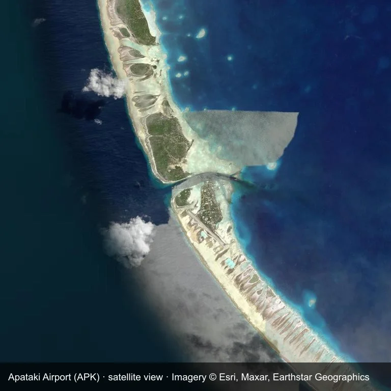
Satellite view: Apataki Airport (APK) set among a patchwork of vegetation and open ground.
Satellite imagery © Esri, Maxar, Earthstar Geographics; the field and attribution are labelled in the image. This is an overhead view, not a ground-level photograph.
Airport at a glance
| Item | Detail |
|---|---|
| IATA / ICAO | APK / NTGD |
| Role | small airport |
| Elevation | about 2 m |
| Coordinates | -15.5736, -146.4150 |
| Runways | 1, longest 870 m |
| Non-stop destinations | 0 in the 2014 snapshot |
Runways
| Runway | Length | Surface |
|---|---|---|
| 12/30 | 870 m | — |
Why there is no route table
The 2014 snapshot lists no destinations from APK. Schedules for fields this size change quietly, so verify with the operator rather than assuming there is no service.
Nearby airports
| Airport | Distance | Non-stop destinations |
|---|---|---|
| Arutua Airport (AXR) | ~42.2 km | 1 |
| Kaukura Airport (KKR) | ~51.3 km | 1 |
| Fakarava Airport (FAV) | ~97.1 km | 2 |
Getting there and navigating
- Coordinates: -15.5736, -146.4150
- Open in a map: Google Maps | Amap | Baidu Maps
The map on this page shows the airfield and nearby roads. Terminal connections and local transport are not covered here; the operator can confirm them.
Local context
The site at Apataki Airport is set in a patchwork of vegetation and open ground in French Polynesia. Its main runway, 12/30, is aligned northwest–southeast and measures 870 m; the field lies at about 2 m.
With 870 m of runway, the airport sits in the small-aircraft bracket. The surface type is not listed in the open data. The closest airport, Arutua Airport, lies 42.2 km away, with 1 destination in the same snapshot.
Because no scheduled routes were captured in 2014, the practical question is charter or private access; ask the operator before building an itinerary around it.
Before you fly
- The 870 m runway limits operations to small aircraft; baggage and payload limits are usually strict.
- Arutua Airport is 42.2 km away with 1 destination in the 2014 snapshot, making it the nearest alternative for a scheduled flight.
- Treat this as a general-aviation or charter field rather than a large terminal; confirm handling and opening hours in advance.
- The site has no terminal guide on this page, so allow extra time for local arrangements and onward transport.
About the data
Runway and location data follow OurAirports. The route table is the June 2014 OpenFlights snapshot and may lag current airline schedules.
Komentar pembacaDiskusi
Pertanyaan, laporan perjalanan, dan koreksi sangat kami harapkan. Komentar bersifat publik.
Memuat…
Memuat komentar…