
Riviera Villanova d'Albenga International Airport
 Albenga · Italia· Riviera Villanova d'Albenga International Airport
Riviera Villanova d'Albenga International Airport (IATA: ALL, ICAO LIMG) adalah bandara sedang yang melayani Albenga, Italia.
Riviera Villanova d'Albenga International Airport is a medium-sized airport, at an elevation of about 148 ft. This page gathers its location map, airport codes and travel information.
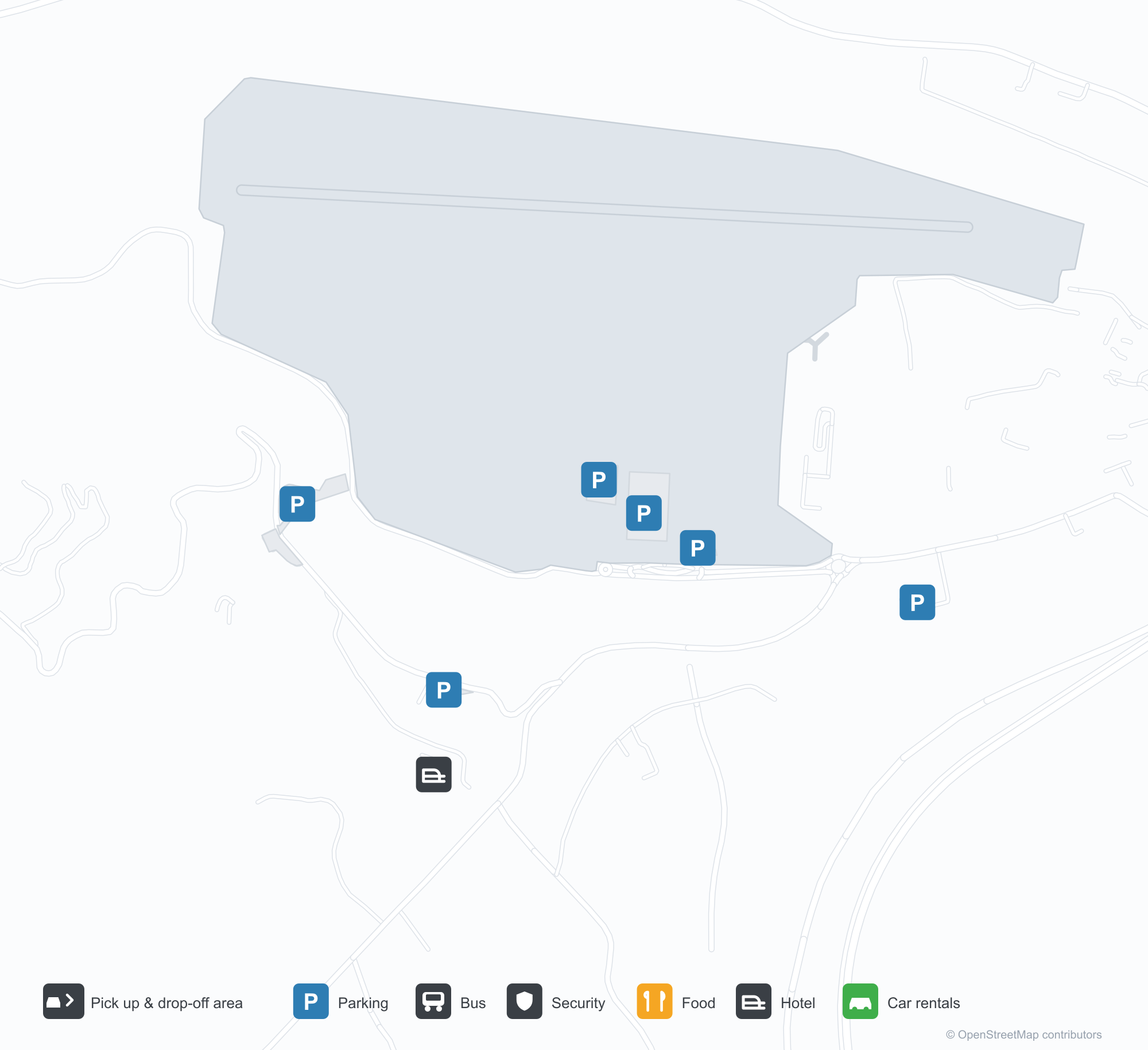
Unduh Peta BandaraUnduhan
Foto bandaraFoto Bandara
Foto asli bandara ini, masing-masing dikreditkan ke halaman web publik tempat foto ditemukan; hak cipta tetap milik fotografer aslinya. Klik foto untuk memperbesar, atau baris kredit untuk membuka halaman sumbernya.
Pada citra satelit, landasan pacu Bandara Internasional Riviera Villanova d'Albenga (ALL) terletak di antara vegetasi hijau dan lahan pertanian.
Dilihat dari udara, landasan pacu Albenga terletak di lembah hijau di samping dasar sungai kerikil yang lebar, dengan pegunungan menjulang di balik lapangan.
Menara kontrol merah putih menjulang di belakang bangunan terminal rendah, dengan nama ALBENGA tertulis di dinding di depannya dan pegunungan di kejauhan.
Saat senja, dua pesawat jet bisnis berdiri di apron beton Bandara Albenga, dengan bangunan terminal berfasad kaca di belakangnya.
Dalam cahaya senja di Albenga, pesawat baling-baling bermesin tunggal kecil berwarna putih dan kuning berdiri di apron, pegunungan gelap di kejauhan.
Dari udara, landasan pacu Albenga dan padang rumputnya yang luas terletak di antara jalan dan dasar sungai, dengan kota pesisir dan laut di kejauhan.
Helikopter beristirahat di apron di depan hanggar tenda putih di Albenga, di bawah langit biru penuh awan bergumpal.
Informasi & detail bandaraDetail Bandara
Peta interaktif — lokasi Riviera Villanova d'Albenga International AirportPeta Interaktif
Lihat bandara ini di layanan peta lain:
Riviera Villanova d'Albenga International Airport (ALL) Guide: No scheduled services on recordPanduan Bandara
The satellite view of Riviera Villanova d'Albenga International Airport (ALL) in Italy shows dense green vegetation and small fields around the field. At about 45 m above sea level, the airport has a single 1,432 m runway. No scheduled routes appear in 2014; the closest airport is Cuneo International Airport, 68.3 km away.
Satellite view
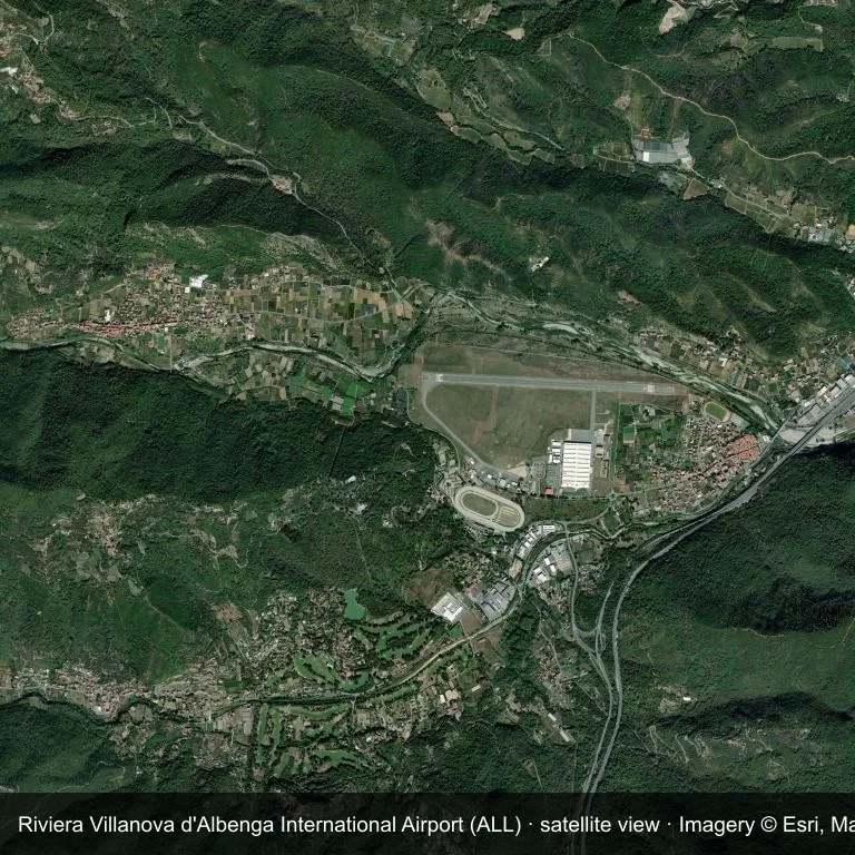
Satellite image: Riviera Villanova d'Albenga International Airport (ALL) lies among dense green vegetation and small fields.
Imagery: Esri World Imagery (© Esri, Maxar, Earthstar Geographics), with attribution in the image. It shows the field from orbit, not from the ground.
Airport at a glance
| Item | Detail |
|---|---|
| IATA / ICAO | ALL / LIMG |
| Role | medium-sized airport |
| Elevation | about 45 m |
| Coordinates | 44.0506, 8.1274 |
| Runways | 1, longest 1,432 m |
| Non-stop destinations | 0 in the 2014 snapshot |
Runways
| Runway | Length | Surface |
|---|---|---|
| 09/27 | 1,432 m | ASP |
Why there is no route table
ALL has an empty route table in the 2014 snapshot. The dataset only covers services it recorded, so treat the blank as a gap rather than a closure notice.
Nearby airports
| Airport | Distance | Non-stop destinations |
|---|---|---|
| Cuneo International Airport (CUF) | ~68.3 km | 5 |
| Genoa Cristoforo Colombo Airport (GOA) | ~69.6 km | 17 |
| Nice-Côte d'Azur Airport (NCE) | ~85.1 km | 86 |
Getting there and navigating
- Coordinates: 44.0506, 8.1274
- Open in a map: Google Maps | Amap | Baidu Maps
The map shows the field in its local road context. This page does not cover terminal links or local transport; confirm those with the operator.
Airport sketch
Riviera Villanova d'Albenga International Airport occupies ground in Italy surrounded by dense green vegetation and small fields. The 09/27 runway runs east–west and offers 1,432 m of asphalt; elevation is about 45 m.
The runway gives 1,432 m of asphalt, a turboprop and light-jet profile. The paved surface supports regular operations, though it does not imply scheduled service. Cuneo International Airport is 68.3 km away, with 5 destinations in the same snapshot.
With no routes in the 2014 data, this is not a reliable scheduled destination. Use Cuneo International Airport as the nearest back-up and verify access with the airport operator.
Before you fly
- At 1,432 m, the runway suits turboprops and smaller jets rather than widebodies; confirm the aircraft type with the operator.
- The runway is paved, which supports year-round operations, but scheduled service is still not guaranteed.
- Cuneo International Airport is 68.3 km away with 5 destinations in the 2014 snapshot, making it the nearest alternative for a scheduled flight.
- The site has no terminal guide on this page, so allow extra time for local arrangements and onward transport.
- Treat this as a general-aviation or charter field rather than a large terminal; confirm handling and opening hours in advance.
About the data
Runways, elevation and coordinates come from OurAirports open data; routes come from the June 2014 OpenFlights snapshot. That snapshot describes network shape and scale, not current schedules.
Komentar pembacaDiskusi
Pertanyaan, laporan perjalanan, dan koreksi sangat kami harapkan. Komentar bersifat publik.
Memuat…
Memuat komentar…